GIS Solutions
Discover powerful GIS solutions: Unlock location intelligence, optimize operations, and make data-driven decisions for business success


4.8 out of 5
Based on user feedback from Gartner Peer Insights, Capterra and GetApp. Sourceforge Top Performer Winter 2023.
The leading provider of GIS solutions.
Generating significant productivity gains, our solutions guide companies’ business analyses, guarantee a high level of service and increase customer satisfaction.
2200+
Customers
177K+
users
170+
employees
28
countries
30+
years of experience
GIS Products and Services
Explore our GIS solutions to optimize and enhance your business analyses!
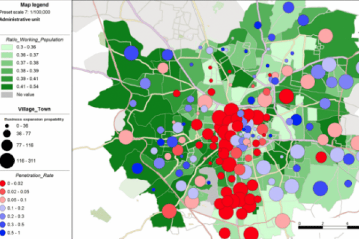
Geomarketing
Geo-driven Sales & Marketing: Unify data, gain insights, optimize strategies.
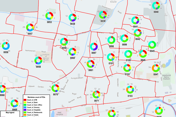
Census area maps
The census areas or administrative units for carrying out your geo-marketing analyses.
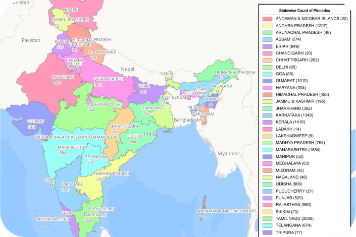
Pincode boundaries
Nomadia offers accurate pincode datasets as a part of its GIS solutions.