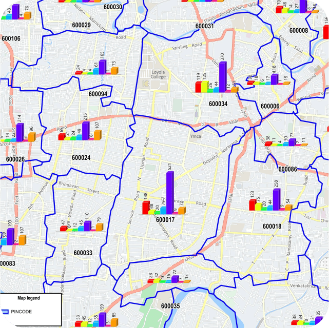
Pincode boundaries
For any geomarketing or business intelligence analysis to be carried out the most important factor is being able to place or identify geographically your customers and your sales network. With the relative addressing system in India this becomes one of the major roadblocks for any analysis. The pincode data provides a concrete basis for placing your customers and sales network points on the map. Nomadia offers accurate pincode data as part of its geomarketing data package.
A critical location information for any geo-marketing analysis
-
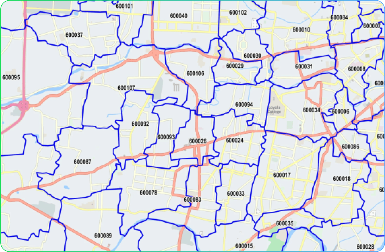
Pincode boundaries data
The Standard data offering for Pincode boundary for India includes information on the 6-digit pincodes the state names and state codes of each of the pincode regions.
-
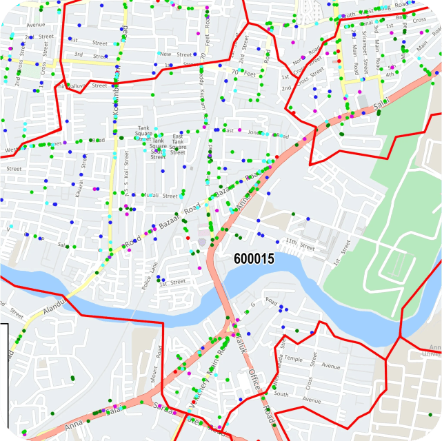
Pincode Boundaries data with village and Town Points
Nomadia also offers the Pincode Boundary data along with accurate village and town point locations linked to the year 2011 primary census abstracts This allows you to create accurate territory based on pincodes and identify villages/towns/ wards that fall within pincode regions
-
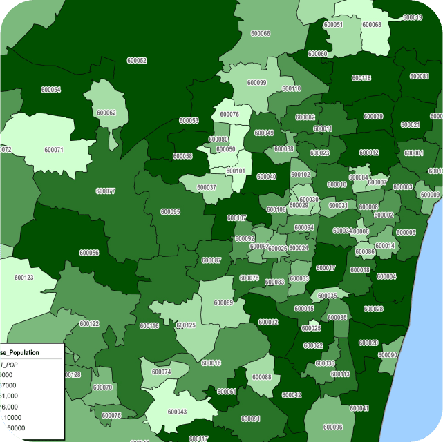
Pincode Boundary data associated to Population totals
Population totals of villages and Town points can be aggregated for each Pincode Boundary. This enables you to understand the demographics of the Pincode. This demographic information along with additional location information of POI categories within the Pincode help create a geographic profile for your territory that can be associated with low or high sales performance in the region. This would also help you identify similar areas that you can target for strategic business expansion.
-
Constant update
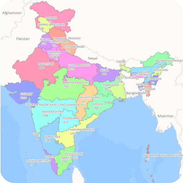
The current coverage for the data includes all the states and union territories of India. This data is updated every year.
Product FAQs
Pincode Boundaries play a critical role in geo-marketing and business intelligence analysis by enabling you to map the geographical location of customers and your sales network.
In India, where the relative addressing system can be challenging, accurate pincode data is essential for precise geo-marketing insights.
The standard data for Pincode boundaries in India includes information on 6-digit Pincodes, state names, state codes and district information for each Pincode region.
This data forms the foundation for placing customers and sales network points on the map
Yes, Nomadia offers Pincode Boundary data along with accurate village and town point locations linked to the primary census abstracts.
This comprehensive dataset allows you to create precise territories based on pincodes and identify villages, towns, and wards within pincode regions.
Pincode Boundary data includes population totals for villages and town points within each Pincode Boundary.
This information helps you understand the demographics of each pincode area and allows you to create a geographic profile for your territory.
This profile can be associated with low or high sales performance in different regions, aiding strategic business expansion.
Yes, Nomadia ensures that the Pincode Boundary data is constantly updated.
The current coverage includes all states and union territories of India, and this data is refreshed annually to provide you with the most current and accurate information for your geo-marketing analyses.
Request a personalized demonstration or a quote
Want to learn about our prices, receive a personalized demonstration or request a specific quote? Enter your contact information below, and our experts will get back to you as soon as possible.
Any further questions?
You’ll find the answers to our customers’ most frequently asked questions here.
Nomadia is the leading French publisher of SaaS Smart Mobility solutions, guiding more than 175,000 professionals in the field every day. Our solutions are easy to use and quick to roll out, and they guarantee a significant, immediate return on investment.
Combining the expertise of a software integrator / editor with that of a consulting firm, Nomadia’s teams provide you with customized support, from data consulting to the roll-out of mobile terminals. Moreover, our technical support is available 24 hours a day, seven days a week.
Nomadia solutions guide the digital transformation of all types of mobile professionals: traveling sales representatives, delivery drivers, technicians, auditors, healthcare personnel, diagnosticians, service providers, patrolmen, experts, and more.
From small- and medium-sized companies to large corporations, our solutions can be adapted to companies of any size and in any sector.
Each Nomadia solution consists of a ready-to-use SaaS which includes a back office and a mobile business application specially designed for field operations.
Our APIs and their many connectors allow you to integrate our technologies into third-party applications, whether those are custom solutions or market standards.
Our consultant teams can also help you set up a customized solution that is perfectly adapted to your business processes.
Yes! Contact our team to get an evaluation version of the solution of your choice.
As a company committed to the planet, Nomadia naturally asserts a strong CSR (Corporate Social Responsibility) approach. We integrate social, ecological and economic issues into everything we do.
By optimizing the mobility of mobile professionals, our solutions help improve our customers’ productivity, the well-being of their employees, and the impact of their businesses on the environment.
The Nomadia teams are available to answer all your questions:
- via our online form
- by phone at +91 4443156075